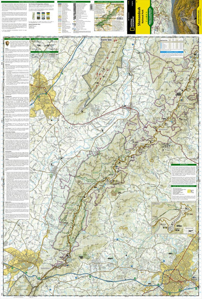
228 Shenandoah National Park (south side)
- Camping
- Fishing
- Hiking
- Skiing
This product can only be purchased in the following bundle(s).
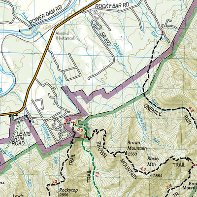
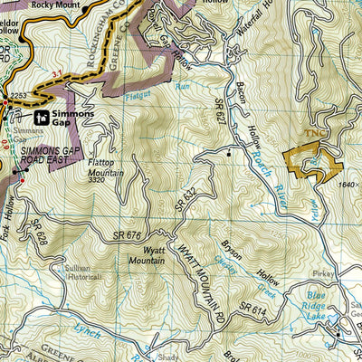
Expertly researched and created in partnership with local land management agencies, National Geographic’s Trails Illustrated map of Shenandoah National Park provides an unparalleled tool for exploring this beautiful park. Particular attention is shown to camping, hiking, fishing, ranger programs,...
Geographic area:
Category:
Parks & Forests
Size:
56.74MB
Publication:
2015
Language:
English
Map bounds
Check nearby mapsWhat you get with Avenza Maps

Reliable mapping tools
Record GPS tracks, add placemarks, add photos, measure distances, and much more.

Locate yourself with GPS
Avenza Maps offline GPS app on your mobile device can locate you on any map, without WiFi or network connectivity.

The best maps by the best publishers
Download professionally curated digital maps on the Avenza Map Store from the best-renowned publishers.